File:Portion-t27n-r40ewm-1600.jpg: Difference between revisions
Jump to navigation
Jump to search
(1912 Spokane County Atlas showing location of Curby Post Office and LaPray Bridge.) |
m (Bot: Adding category Pioneer Stories) |
||
| Line 1: | Line 1: | ||
== Summary == | == Summary == | ||
1912 Spokane County Atlas showing location of Curby Post Office and LaPray Bridge. | 1912 Spokane County Atlas showing location of Curby Post Office and LaPray Bridge. | ||
[[Category:Pioneer Stories]] | |||
Latest revision as of 08:57, 26 August 2023
Summary
1912 Spokane County Atlas showing location of Curby Post Office and LaPray Bridge.
File history
Click on a date/time to view the file as it appeared at that time.
| Date/Time | Thumbnail | Dimensions | User | Comment | |
|---|---|---|---|---|---|
| current | 08:19, 24 March 2023 | 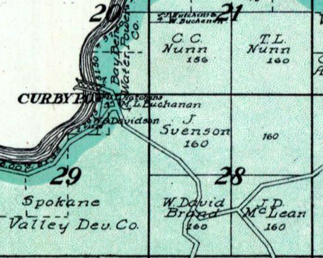 | 1,127 × 900 (264 KB) | Kirk (talk | contribs) | 1912 Spokane County Atlas showing location of Curby Post Office and LaPray Bridge. |
You cannot overwrite this file.
File usage
The following page uses this file: